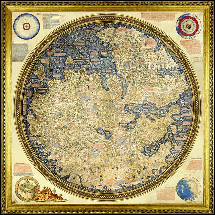
The Mappa Mundi by Fra Mauro, created around 1450. (Photo: Wikimedia Commons, Public Domain)
Before satellites and air flight, one might think mapping the contours of continents and the shores of seas accurately was nearly impossible. However, careful research alone could sometimes produce useable, surprisingly accurate renditions of geography. In the 15th century, a medieval monk known as Fra Mauro bucked cartographic tradition and carefully crafted a massive eight-foot by eight-foot map of the then-known world. Created for King Afonso V of Portugal, this Mappa Mundi (World Map) features over 3,000 locations across Africa, Europe, and Asia. While some may have fantastical stories and illustrations, the contours of this world match quite well the real boundaries of the land.
Fra Mauro was born around 1400, and he spent part of his youth traveling on merchant and military ships. He eventually became a monk at the Monastery of St. Michael, an outpost of the Camaldolese order that was perched on the Venetian island of Murano. There, he received a commission to create a world map for the king of Portugal, and he set to work. The map, completed around 1450, was essentially “crowd-sourced” like a medieval Google Maps, says Atlas Obscura. Living in a center of robust Mediterranean trade, the monk actively solicited insight and myths about the far corners of the then-known world from sailors, merchants, soldiers, and pilgrims. He then compiled them, with some assistance, into a map.
At a glance, one may not recognize the continents, as the map was drawn “upside down.” Stretching to the edges of the globe are the southern coast of Africa, Scandinavia, and the outer edge of what is now Russia. Ships, some labeled in Chinese, dot the wavy waters as far away as India. Almost 3,000 cities and sites are labeled and illustrated. Some are accompanied by troglodytes, seven-headed serpents, or gold lakes.
Clearly, the monk did not believe every legend he was told, noting in some places his disbelief. Impressively, this is the first European map to correctly depict Japan as an island. It also eschews certain Biblical fictions by not placing the Garden of Eden and its inhabitants at the center of the physical world. While not the only world map produced with accuracy, compared to the Hereford Mappa Mundi created about 150 years prior, the precision of Fra Mauro’s map is especially stunning.
Fra Mauro, a 15th-century Venetian monk, created a large map of the world then known to Europeans.
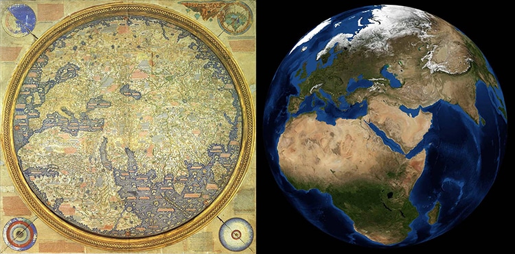
Comparing the map to the real planet. (Photo: Wikimedia Commons, Public Domain)
Despite fantastical contents, this Mappa Mundi surprisingly tracks the outlines of actual continents.
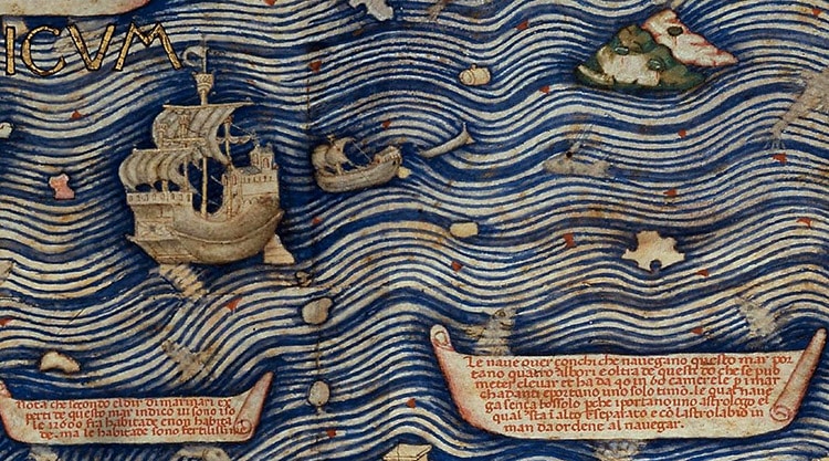
A close-up of Chinese ships in the Indian Ocean. (Photo: Wikimedia Commons, Public Domain)
Watch this video to learn more about Fra Mauro’s stunning feat of cartography.
h/t: [Open Culture, Atlas Obscura]
Related Articles:
Insightful Map Reveals Different Etiquette Practices Around the World
Artist Spent Three Years Drawing Map of the World with 1,642 Animals
Incredible Sky Map Details Over 900,000 Stars, Galaxies, and Black Holes
Explore the Impressively Accurate Medieval World Map by a 12th-Century Islamic Scholar