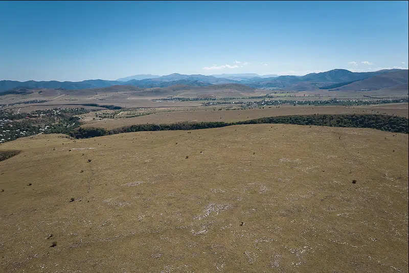
Concealed by thick summer grass, Dmanisis Gora, a 3,000-year-old fortress in the mountains of Georgia, had been hiding its immense size during initial excavations by archeologists. Now, through astounding findings published in the journal Antiquity, a reassessment of the factors driving ancient settlement population growth has been prompted.
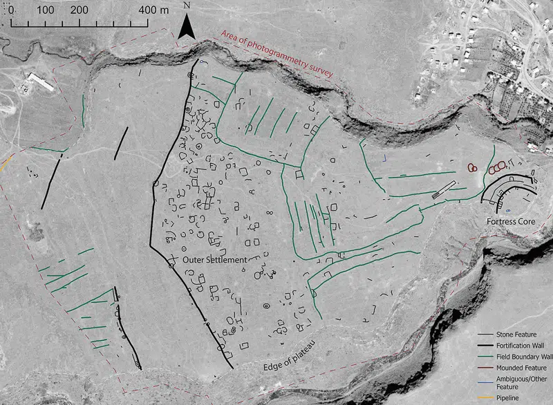
In fall 2018, researchers from Cranfield University returned to the site, where the fading greenery revealed both an inner and outer fortress wall, along with extensive remains of fortifications and stone buildings beyond the previously known inner fortress. Due to the site’s immense size, the researchers opted to use drones rather than struggle on foot, highlighting the important role modern technology plays in archeological research.
“That was what sparked the idea of using a drone to assess the site from the air,” said Nathaniel Erb-Satullo, senior lecturer in archeological science at the Cranfield Forensic Institute, in a statement to Cranfield University. “The drone took nearly 11,000 pictures which were knitted together using advanced software to produce high-resolution digital elevation models and orthophotos—composite pictures that show every point as if you were looking straight down.”
The research team used a DJI Phantom 4 RTK drone to capture high-resolution aerial imagery, which was then carefully verified to map human-made features accurately. They then compared the drone’s orthophotos with 50-year-old images from a declassified Cold War-era spy satellite, using Geographic Information System (GIS) software to analyze changes in the various stony features at the site over time.
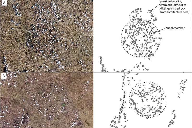
What the researchers uncovered was remarkable. The detailed maps of fortification walls, graves, field systems, and other stone structures showed that the fortress was 40 times larger than originally thought, possibly making it the largest fortress of its kind.
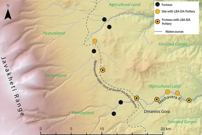
Not only is Dmanisis Gora a significant finding for the South Caucasus, but the site also plays a broader role in understanding the structure and expansion of ancient large-scale settlements. According to Erb-Satullo, the findings necessitate a reevaluation of social dynamics during the Late Bronze and Early Iron Ages.
“We hypothesize that Dmanisis Gora expanded because of its interactions with mobile pastoral groups, and its large outer settlement may have expanded and contracted seasonally. With the site now extensively mapped, further study will start to provide insights into areas such as population density and intensity, livestock movements, and agricultural practices, among others,” Erb-Satullo said.
Since their unprecedented discovery, the research team has begun analyzing the site, uncovering multitudes of artifacts and traces that offer a glimpse into the ancient societies that once inhabited Dmanisis Gora.
Researchers from Cranfield University used drones to map Dmanisis Gora, a 3,000-year-old fortress in Georgia.
They uncovered extensive fortifications, graves, and stone structures, finding that it was 40 times larger than previously believed.
These findings prompt reevaluating ancient settlement growth and dynamics with mobile pastoral groups during the Late Bronze and Early Iron Ages.
Sources: When the past meets the future: Innovative drone mapping unlocks secrets of Bronze Age ‘mega fortress’ in the Caucasus; Archaeologists Discover 3000-Year-Old ‘Mega-Fortress’ 40 Times Larger Than Expected; Drones Uncovered a 3,000-Year-Old Hidden Mega-Fortress in the Mountains
Related Articles:
Researchers Discover 7,000-Year-Old Underwater Road
Explore the History of Windsor Castle, the Longest Occupied Castle in the World
6 European Cities From Medieval Times That Are So Well-Preserved You Can Still Visit Them Today