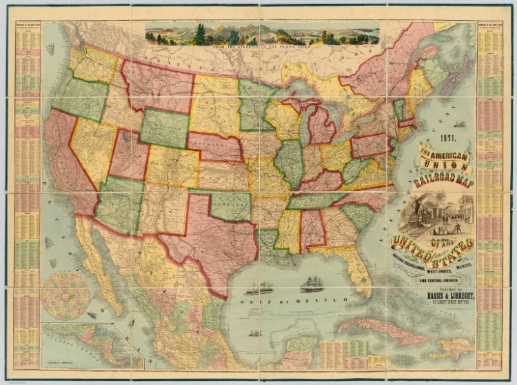
American Union Railroad Map Of The United States, by Haasis & Lubrecht, 1871. (Photo: David Rumsey Map Collection, David Rumsey Map Center, Stanford Libraries)
Maps help us get from place to place, but they also orient us to our surroundings both physically and culturally. They reflect the values and priorities of their creators, as well as the scientific advancements of the times. They can be topological, illustrated, conceptual, and more. For budding cartographers or anyone who might be searching for a particular place in space or history, the David Rumsey Map Collection is an incredible online archive with free high-resolution downloads of thousands of maps from the past 500 years of world history. Since 2019, the archive has added 40,000 new additions across its many categories—which include such gems as a world history board game and a 22-foot-long timeline of world history.
One can search the maps by subject, location, and even by text. Or you can browse thematically, for example, through mythical maps. The collection has countless items, starting around 1550 to modern day. Some were crafted by hand, while others reflect sophisticated geotechnologies. The collection is actually the mirror of a physical maps collection assembled by David Rumsey. Rumsey began his collection in the 1980s and has since donated it to Stanford University. He has also received awards for his tireless effort to digitize and make available the maps in the collection.
Military buffs will find maps of World War I sites, while astronomers can admire these phases of the moon. Compare the heights of the world’s tallest mountains, or view this historical version of Google maps from 1907. Explore maps from the collections of the Ford Motor Company, and learn about the different regions of Mexico through art. Exploring the David Rumsey Map Collection will never get boring, so what will you find today?
David Rumsey began his vast map collection in the 1980s.
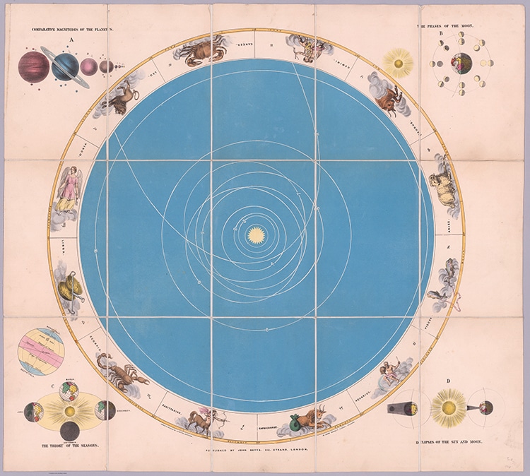
Astronomical Recreation, by John Betts, 1855. (Photo: David Rumsey Map Collection, David Rumsey Map Center, Stanford Libraries)
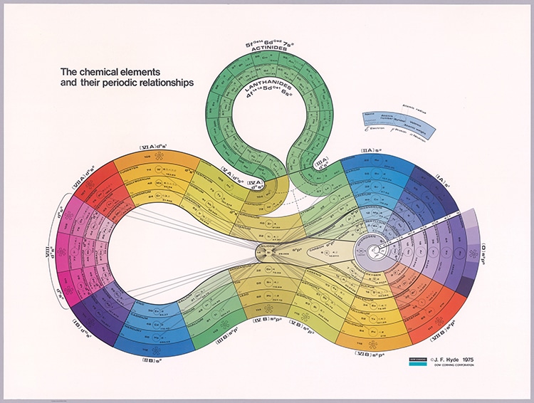
The chemical elements and their periodic relationships, by J.F. Hyde, 1975. (Photo: David Rumsey Map Collection, David Rumsey Map Center, Stanford Libraries)
It now belongs to Stanford University and has been digitized, with over 130,000 maps online.
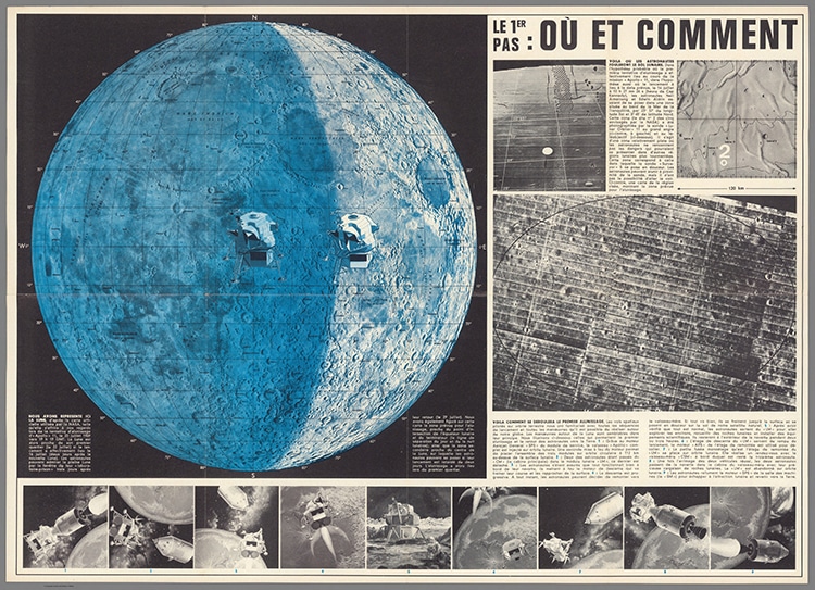
(Apollo 11 Moon Landing) Le 1er Pas: Ou et Comment (The first pass – where and how), by Anonymous, 1969. (Photo: David Rumsey Map Collection, David Rumsey Map Center, Stanford Libraries)
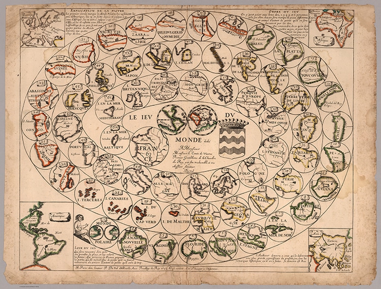
Game of the World, by Pierre Du Val, 1645. (Photo: David Rumsey Map Collection, David Rumsey Map Center, Stanford Libraries)
The collection is truly a cartographer’s dream.
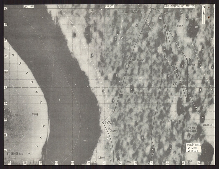
Hadley Rille : EVA – I, I of 2; EVA – II, I of 3. Grid interval 125 Meters, by the USGS Astrogeology Science Center, Geological Survey, 1971. (Photo: David Rumsey Map Collection, David Rumsey Map Center, Stanford Libraries)
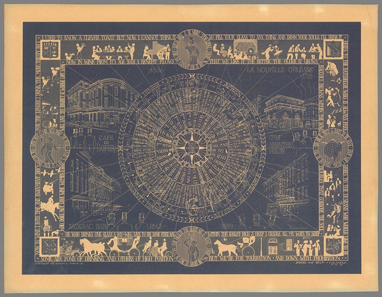
The HOW, WHEN and WHERE of Discriminating and Enjoyable Drinking, by Collins Diboll, 1931. (Photo: David Rumsey Map Collection, David Rumsey Map Center, Stanford Libraries)
David Rumsey Map Collection: Website | Facebook | Instagram
h/t: [Open Culture]
Related Articles:
Mystical History of Astrology: From Ancient Zodiac Maps To Modern Horoscopes
Old Maps Used to Show California as an Island Separate From the Rest of the U.S.
3D Maps Visualize the Stark Population Density Differences in Cities in the U.S.
