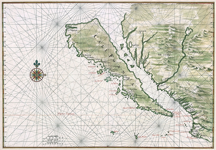
Map by Johannes Vingboons, circa 1650. (Photo: Library of Congress via Wikimedia Commons, Public domain)
California is known for many things. San Francisco cablecars, Hollywood celebrities, and the rolling vineyards of Napa Valley are among its iconic symbols. The state figures large in American culture at home and abroad, but it was once somewhat of a mystery to European explorers. In fact, throughout the 16th and 17th centuries, a strange piece of misinformation appeared on maps throughout Europe. Cartographers showed California as an island.
This misconception came about in the earliest days of European exploration along the west coast of the continent. Much about the coastline was unknown to these newcomers; however, the idea of California as an island is typically attributed to Garci Rodriguez de Montalvo, a novelist who wrote Las Sergas de Esplandián or The Adventures of Esplandián. The book, published in 1510, featured an island named “California” inhabited by Black women and ruled by a queen. While a work of fiction, many believe it inspired the Spanish explorers in the region to name the “island” they discovered, which is now the Baja California Peninsula.
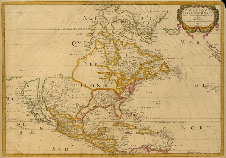
On early 16th-century maps, California was, therefore, drawn as an island. Depicted with colorful designs, the Gulf of California became a channel. Rather than terminating shortly beneath the modern border of what is now the United States and Mexico, it entirely cleaved off the “island” of California.
While some cartographers did get it right geographically, this was not the norm. Many European cartographers produced their maps by copying others, so California frequently appeared as an island throughout the following two centuries. Eventually, 18th-century explorers and cartographers finally corrected this European misinterpretation on a wider scale.
Father Eusebio Kino voyaged in California between 1698 and 1701 before drawing his own map, A Passage by Land to California. In it, he illustrated the peninsula separated from the mainland by what he called “the sea of California,” which terminated in the Colorado River.
While California’s time as an island existed only in the minds of Europeans, rather like a cartographic rumor, it makes for some fascinating moments in map history.
Europeans who came to the Americas and mapped it in the 16th and 17th centuries depicted California as an island on their maps.

“Amerique Septentrionale,” map by Nicolas Sanson, 1650. (Photo: UTA Libraries Cartographic Connections via Wikimedia Commons, Public domain)
The misconception seems to date back to a 16th-century novel by Garci Rodriguez de Montalvo, which described what is now the state as an island.

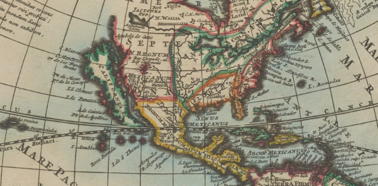
Detail of a 17th-century world map by Pieter van der Aa. (Photo: Stanford Libraries, PDM 1.0 DEED)

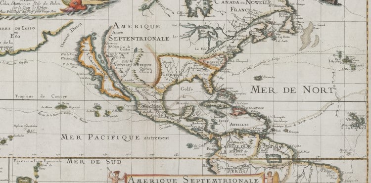
Detail of a 17th-century map by Pierre Duval (Photo: Stanford Libraries, PDM 1.0 DEED)
h/t: [Moss and Fog, Stanford Libraries]
Related Articles:
Explore Five Volumes of the History of Cartography for Free Online
Download Over 91,000 Maps from the World’s Largest Private Collection
Fascinating Map From 1942 Features Oceans as the Main Focus of the World
Who Is Abraham Ortelius? Learn More About the Inventor of the World’s First Atlas
