
Arles Amphitheater (Photo: Lucas Miguel)
Since 1972, UNESCO has been working to preserve monuments around the world by assigning destinations the status of World Heritage Site. As of today, there are 1,121 UNESCO World Heritage Sites, which include both natural and cultural areas. In some cases, entire cities are named to the list for their cultural significance. With so many places in the program, it can be difficult to keep track, but luckily Overview is taking us on a unique tour.
Overview seeks to share the world as seen from above by generating incredible aerial photos. The community primarily uses high-resolution satellite imagery to composite overhead images. They’ve put together a collection of UNESCO World Heritage Sites as seen from above, and the results are astounding. From well-known places like the Great Pyramids of Giza and the Grand Canyon to lesser-known areas like the Sundarbans in Bangladesh, the photos are an excellent opportunity to discover new places and revisit old favorites.
“This project was inspired by an idea known as ‘The Overview Effect,’” shares Overview founder Benjamin Grant. “This term refers to the sensation that astronauts experience when given the opportunity to look down and view the Earth as a whole, from a great distance. They have the chance to appreciate our home in its entirety, to reflect on its beauty and its fragility all at once. Recent studies have shown that this vantage point inspires a greater appreciation for Earth’s beauty, and an increased sense of connection to all other living beings, and an unexpected level of emotion. That’s the shift that I hope to inspire with my work.”
Take a tour around the world with Overview and check out even more pictures on their website; there, you’ll find a map outlining the locales and imagery. If you like what you see, prints of the stunning aerial photography are available for purchase.
Check out these incredible overhead views of UNESCO World Heritage Sites around the globe.

Sydney Opera House (Photo: Nearmap)

Venice (Photo: Maxar technologies)
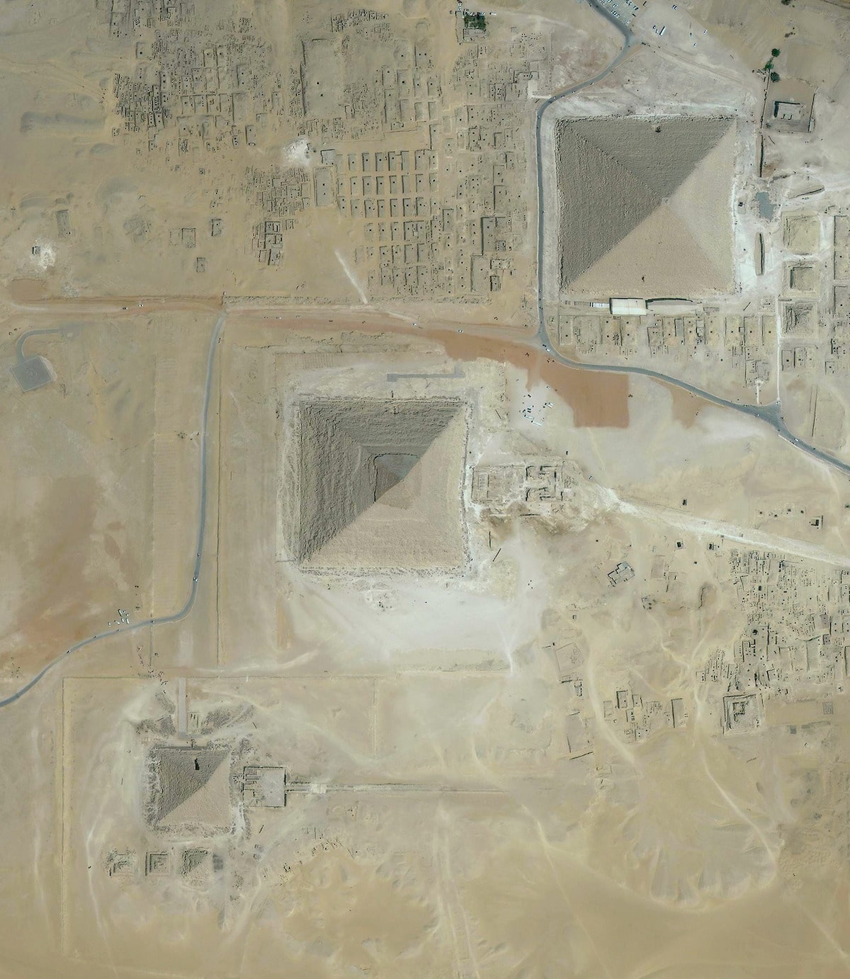
Great Pyramids of Giza (Photo: Digital Globe)

The Sundarbans – Bangladesh (Photo: NASA)

Marrakesh (Photo: Maxar technologies)

Mount Etna (Photo: Planet Labs)

Brasilia (Photo: Digital Globe)

Ayers Rock – Uluru-Kata Tjuta National Park (Photo: Maxar technologies)

Naples (Photo: Maxar technologies)
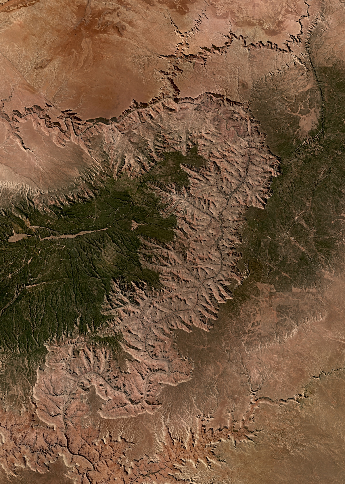
Grand Canyon National Park (Photo: planetlabs)
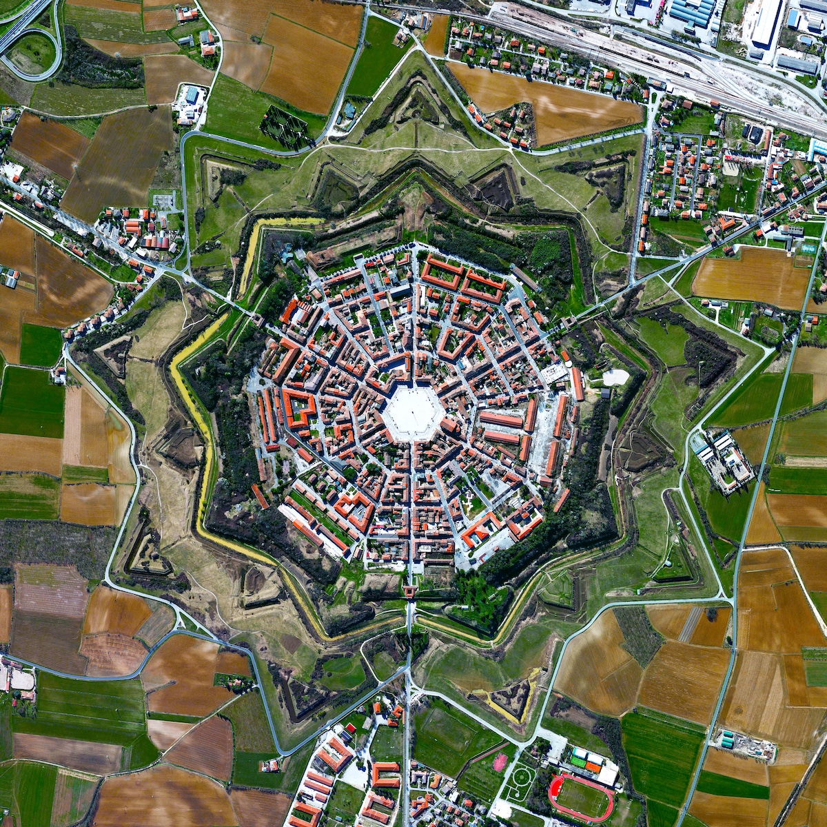
Palmanova (Photo: Daily Overview)
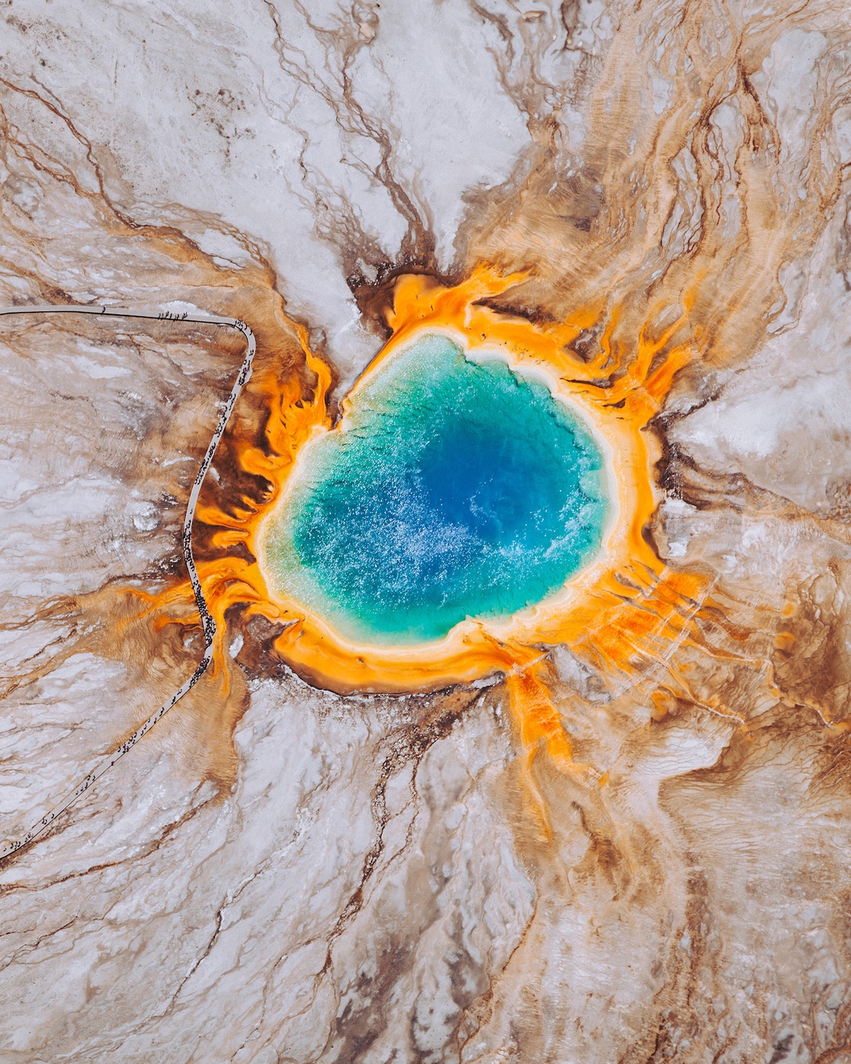
Grand Prismatic Spring – Yellowstone National Park (Photo: Chris Leipelt)
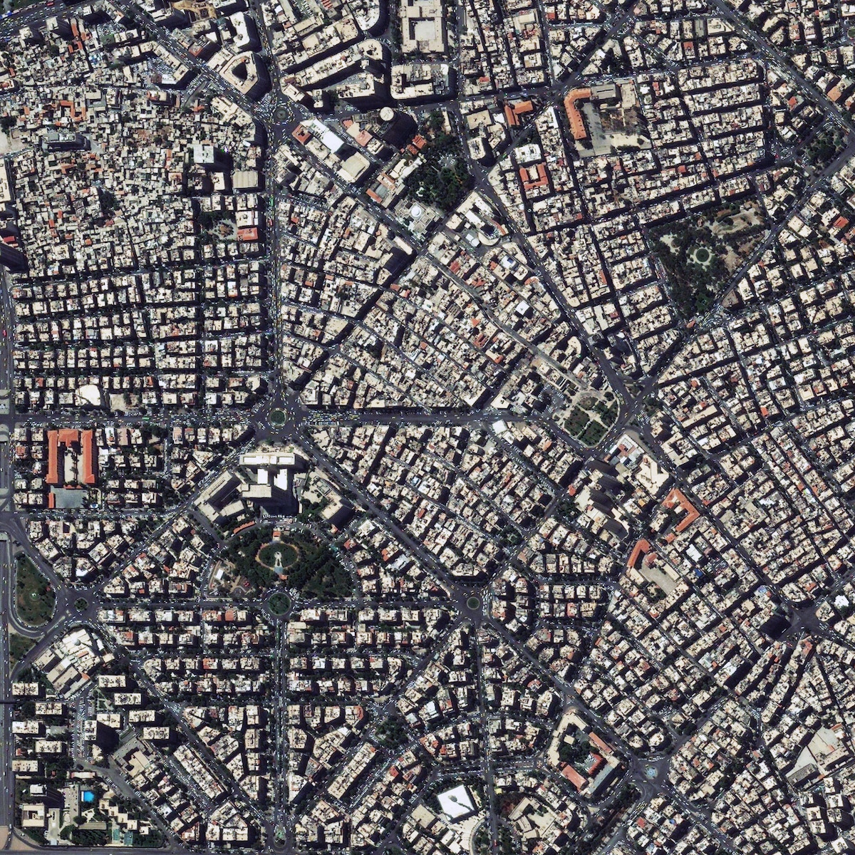
Damascus (Photo: Maxar technologies)

Bern (Photo: Maxar technologies)

Vatnajökull National Park (Photo: Maxar technologies)
