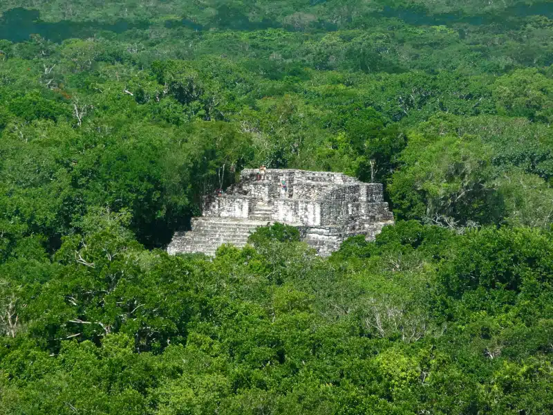
Mayan temple at Calakmul. (Photo: prill/Depositphotos)
For the longest time, looking for archeological ruins came with a lot of physical work. Archeologists would walk through deep forests of jungles with a machete in hand, hoping to come across a promising rock that gave away that a civilization once thrived there. Now, a state-of-the-art technology has helped discover a previously unknown Maya city, and it all began with a Google search.
Knowing the power of laser mapping technology, researcher Luke Auld-Thomas wondered if someone had done previous mapping of the Maya area, in Southeastern Mexico. Curious, he looked up if someone had covered the area with a non-archaeological end. “Scientists in ecology, forestry and civil engineering have been using lidar surveys to study some of these areas for totally separate purposes,” says Auld-Thomas from Northern Arizona University said via a statement. “So what if a lidar survey of this area already existed?”
Lidar is a remote-sensing technology that fires laser pulses and maps objects below by counting the time the signal takes to return, allowing archeologists to spot structures beneath vegetation. However, since this is a pricey resource, it seems no team of archeologists had gotten funds to carry out this mission, especially without a lead.
“I was on something like page 16 of Google search and found a laser survey done by a Mexican organization for environmental monitoring,” Auld-Thomas told BBC. An area of about 47 square miles in Southeastern Campeche had been mapped.
After processing the data, Auld-Thomas found something no one else had ever seen—an ancient city with evidence of more than 6,700 structures. His findings, achieved in collaboration with researchers from Tulane University, Mexico’s National Institute of Anthropology and History, and the University of Houston’s National Center for Airborne Laser Mapping, were recently published in the journal Antiquity.
The site, which was named Valeriana after a nearby lagoon, seems to have been founded before 150 CE, and experienced its splendor from 750 to 850 CE. With a population between 30,000 and 50,000, it was second in density only to Calakmul—located 62 miles away—which has long been regarded as the largest Maya site.
“The ancient world is full of examples of cities that are completely different than the cities we have today,” says Auld-Thomas. “There were cities that were sprawling agricultural patchworks and hyper-dense; there were cities that were highly egalitarian and extremely unequal.”
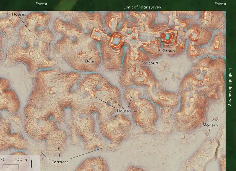
Valeriana is described as having “all the hallmarks of a Classic Maya political capital.” The city, which measures about 6.4 square miles, boasts two enclosed plazas, temple pyramids, a reservoir, and a ball court. Researchers spotted two major centers with large buildings that were about 1.2 miles apart, connected by dense houses and causeways. While complex, the city may have collapsed due to climate change, with a drought likely forcing people to move away.
“Given the environmental and social challenges we’re facing from rapid population growth, it can only help to study ancient cities and expand our view of what urban living can look like,” Auld-Thomas concluded. “Having a larger sample of the human career, a longer record of the accumulated residue of people’s lives, could give us the latitude to imagine better and more sustainable ways of being urban now and in the future.”
A team of researchers found a previously lost Maya city with the help of Lidar, a laser mapping technology.

Detail of Valeriana site core, in the north-east corner of Block 2 (figure by authors). (Photo: Antiquity , CC BY 4.0)
Named Valeriana after a nearby lagoon, the city boasts two enclosed plazas, temple pyramids, a reservoir, and a ball court.

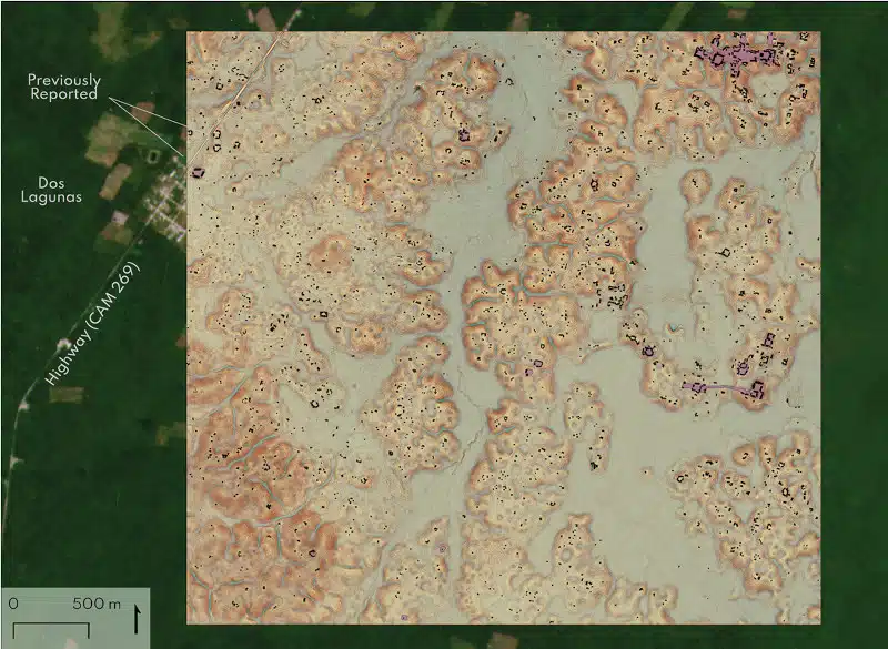
Block 2, showing the major site of Valeriana. Structure footprints in black, platform footprints in purple. Two mound groups adjacent to the highway were reported by Merk (Reference Merk2004) (figure by authors). (Photo: Antiquity, CC BY 4.0)
h/t: [Smithsonian Magazine]
Related Articles:
Archeologists Unearth Ancient Maya Beekeeping Tools in Southeastern Mexico
Agriculture on Mars Is Closer to Reality Thanks To Mayan Farming Practices
Ancient Maya City Discovered Under Jungle Forests in Mexico After 1,000 Years
Radar Technology Discovers Intricate Ancient Mayan Civilization in Northern Guatemala
